
Traismauer topographic map
Interactive map
Click on the map to display elevation.
About this map
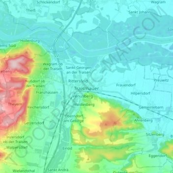
Name: Traismauer topographic map, elevation, terrain.
Location: Traismauer, Bezirk St. Pölten, Lower Austria, 3133, Austria (48.31386 15.68039 48.38818 15.84253)
Average elevation: 226 m
Minimum elevation: 178 m
Maximum elevation: 436 m