
Municipio Roma XII topographic map
Interactive map
Click on the map to display elevation.
About this map
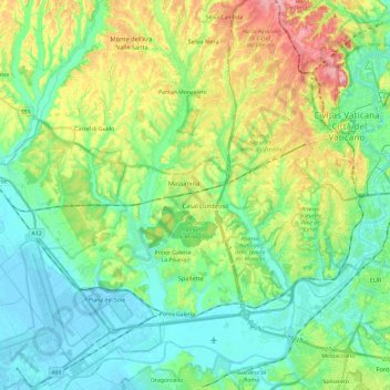
Name: Municipio Roma XII topographic map, elevation, terrain.
Location: Municipio Roma XII, Rome, RM, Lazio, Italy (41.83650 12.23691 41.90830 12.47490)
Average elevation: 45 m
Minimum elevation: -3 m
Maximum elevation: 147 m