
Ramsgate topographic map
Interactive map
Click on the map to display elevation.
About this map
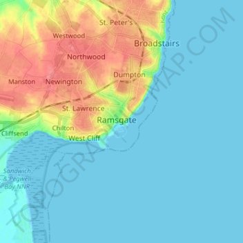
Name: Ramsgate topographic map, elevation, terrain.
Location: Ramsgate, Kent, South East, England, CT11 8HJ, United Kingdom (51.29285 1.38229 51.37285 1.46229)
Average elevation: 14 m
Minimum elevation: 0 m
Maximum elevation: 56 m