
Cahora Bassa topographic map
Interactive map
Click on the map to display elevation.
About this map
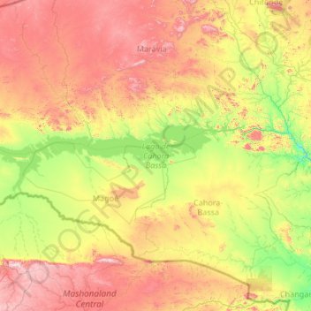
Name: Cahora Bassa topographic map, elevation, terrain.
Location: Cahora Bassa, Tete, Mozambique (-15.96931 30.65756 -15.49875 32.71577)
Average elevation: 597 m
Minimum elevation: 155 m
Maximum elevation: 1,559 m