
Fern Hill topographic map
Interactive map
Click on the map to display elevation.
About this map
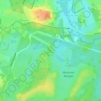
Name: Fern Hill topographic map, elevation, terrain.
Average elevation: 86 m
Minimum elevation: 71 m
Maximum elevation: 111 m
Other topographic maps
Click on a map to view its topography, its elevation and its terrain.
Four Ways
United Kingdom > England > East Hampshire
Four Ways, East Hampshire, Hampshire, South East, England, GU10 4LR, United Kingdom
Average elevation: 101 m
Froxfield and Privett
United Kingdom > England > East Hampshire
Froxfield and Privett, East Hampshire, Hampshire, South East, England, United Kingdom
Average elevation: 164 m