
El Hierro topographic map
Interactive map
Click on the map to display elevation.
About this map
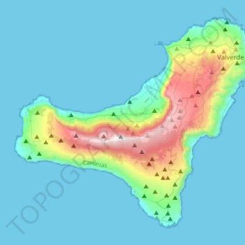
Name: El Hierro topographic map, elevation, terrain.
Location: El Hierro, Santa Cruz de Tenerife, Canary Islands, Spain (27.63774 -18.16087 27.84928 -17.88281)
Average elevation: 210 m
Minimum elevation: 0 m
Maximum elevation: 1,498 m