
Deutschlandsberg topographic map
Interactive map
Click on the map to display elevation.
About this map
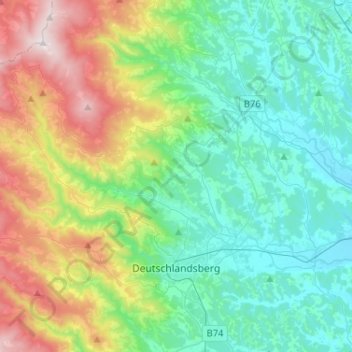
Name: Deutschlandsberg topographic map, elevation, terrain.
Location: Deutschlandsberg, Styria, Austria (46.79310 15.00792 46.92792 15.26645)
Average elevation: 614 m
Minimum elevation: 298 m
Maximum elevation: 1,458 m