
Glenfield topographic map
Interactive map
Click on the map to display elevation.
About this map
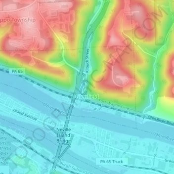
Name: Glenfield topographic map, elevation, terrain.
Location: Glenfield, Allegheny County, Pennsylvania, USA (40.51314 -80.15299 40.52600 -80.12029)
Average elevation: 267 m
Minimum elevation: 210 m
Maximum elevation: 367 m