
Kielce County topographic map
Interactive map
Click on the map to display elevation.
About this map
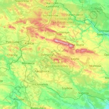
Name: Kielce County topographic map, elevation, terrain.
Location: Kielce County, Holy Cross Voivodeship, Poland (50.53648 20.09240 51.06666 21.17416)
Average elevation: 263 m
Minimum elevation: 153 m
Maximum elevation: 603 m
Other topographic maps
Click on a map to view its topography, its elevation and its terrain.
Krakowski
Poland > Holy Cross Voivodeship > Busko County > Górki
Krakowski, Górki, gmina Wiślica, Busko County, Holy Cross Voivodeship, Poland
Average elevation: 175 m
Starachowice County
Poland > Holy Cross Voivodeship
Starachowice County, Holy Cross Voivodeship, Poland
Average elevation: 237 m
Starachowice
Poland > Holy Cross Voivodeship > Starachowice County > Starachowice
Starachowice, Starachowice County, Holy Cross Voivodeship, 27-200, Poland
Average elevation: 241 m