
Samnaun topographic map
Interactive map
Click on the map to display elevation.
Samnaun
Until 2017 it was part of the Ramosch sub-district, of the Inn district, after 2017 it was part of the Engiadina Bassa/Val Müstair Region. It is located in a left side valley of the Engadin valley, at an elevation of 1,700–1,840 meters (5,580–6,040 ft). It consists of five village sections; Compatsch, Laret, Plan (Plaun), Ravaisch and Samnaun.
About this map
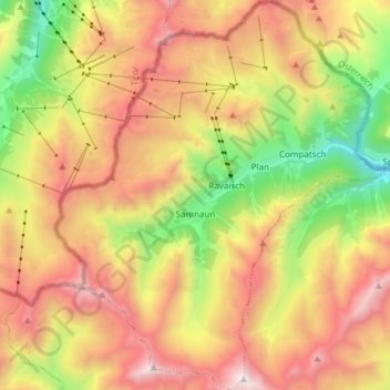
Name: Samnaun topographic map, elevation, terrain.
Average elevation: 2,369 m
Minimum elevation: 1,481 m
Maximum elevation: 3,262 m