
Central Greece topographic map
Interactive map
Click on the map to display elevation.
Central Greece
The region is one of the most mountainous in Greece, having some of the highest elevations in the country.
About this map
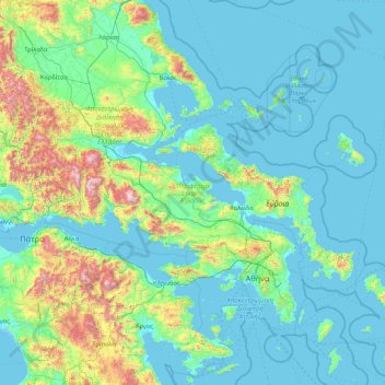
Name: Central Greece topographic map, elevation, terrain.
Location: Central Greece, Thessaly and Central Greece, Greece (37.89138 21.37393 39.27322 24.81268)
Average elevation: 264 m
Minimum elevation: -5 m
Maximum elevation: 2,414 m
Other topographic maps
Click on a map to view its topography, its elevation and its terrain.
Battle of Thermopylae
Greece > Thessaly and Central Greece > Phthiotis Regional Unit > Municipal Unit of Lamia
Archaeological evidence, such as the Serpent Column (now in the Hippodrome of Constantinople), also supports some of Herodotus' specific reports. George B. Grundy was the first modern historian to do a thorough topographical survey of Thermopylae, and led some modern writers (such as Liddell Hart) to revise…
Average elevation: 122 m
Dytiki Soufla
Greece > Thessaly and Central Greece > Regional Unit of Phocis > Municipal Unit of Vardousia
Average elevation: 1,893 m