
Newington topographic map
Interactive map
Click on the map to display elevation.
About this map
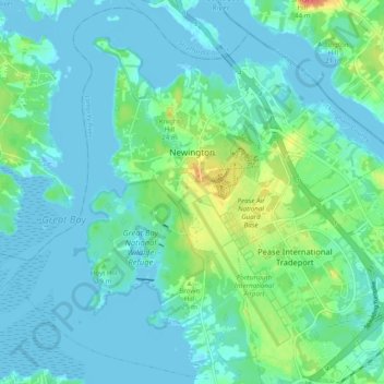
Name: Newington topographic map, elevation, terrain.
Average elevation: 10 m
Minimum elevation: -7 m
Maximum elevation: 47 m
According to the United States Census Bureau, the town has a total area of 12.5 square miles (32.4 km2), of which 8.2 square miles (21.2 km2) is land and 4.2 square miles (10.9 km2) is water, comprising 34.25% of the town. The highest elevation in Newington is 130 feet (40 m) above sea level, near Newington Cemetery.