
Helena-West Helena topographic map
Interactive map
Click on the map to display elevation.
About this map
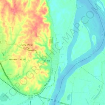
Name: Helena-West Helena topographic map, elevation, terrain.
Average elevation: 67 m
Minimum elevation: 43 m
Maximum elevation: 124 m
The city of Helena was founded by European Americans in 1833, as a port along the Mississippi River. Crowleys Ridge provided elevation and some protection against flooding, a rare feature along the right/west bank of the lower Mississippi River.