
Casuarina Beach topographic map
Interactive map
Click on the map to display elevation.
About this map
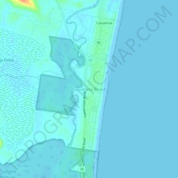
Name: Casuarina Beach topographic map, elevation, terrain.
Location: Casuarina Beach, Tweed Shire Council, 2488, Australia (-28.32379 153.55001 -28.28379 153.59001)
Average elevation: 3 m
Minimum elevation: -2 m
Maximum elevation: 42 m
Australia trails, hiking, mountain biking, running and outdoor activities
Other topographic maps
Click on a map to view its topography, its elevation and its terrain.