
Albany Creek topographic map
Interactive map
Click on the map to display elevation.
About this map
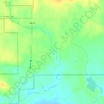
Name: Albany Creek topographic map, elevation, terrain.
Average elevation: 200 m
Minimum elevation: 187 m
Maximum elevation: 216 m
Other topographic maps
Click on a map to view its topography, its elevation and its terrain.
Lake Superior
United States of America > Michigan > Sault Ste. Marie > Shallows
Lake Superior, the largest of the Great Lakes of North America, is also the world's largest freshwater lake by surface area, and the third largest freshwater lake by volume. It is shared by the Canadian province of Ontario to the north, the U.S. state of Minnesota to the west, and Wisconsin and the Upper…
Average elevation: 318 m
White Lake Township
United States of America > Michigan > White Lake Township
Average elevation: 303 m
Fort Holmes
United States of America > Michigan > Mackinac Island > Fort Holmes
Average elevation: 192 m