
Tagong topographic map
Interactive map
Click on the map to display elevation.
Tagong
It is the location of Lha'ggong Monastery — a gompa and one of the most important in the area, in Tibetan Pel Lhagong. It was established with reference to a nearby sacred mountain, Mt. Yala or Zhara Lhaste, 5,820 metres (19,090 ft) in elevation.
About this map
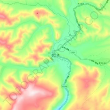
Name: Tagong topographic map, elevation, terrain.
Average elevation: 3,874 m
Minimum elevation: 3,626 m
Maximum elevation: 4,188 m