
Thowgla Upper topographic map
Interactive map
Click on the map to display elevation.
About this map
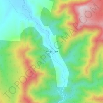
Name: Thowgla Upper topographic map, elevation, terrain.
Location: Thowgla Upper, Shire of Towong, Victoria, Australia (-36.33720 147.88994 -36.29720 147.92994)
Average elevation: 588 m
Minimum elevation: 385 m
Maximum elevation: 907 m