
Peguyangan topographic map
Interactive map
Click on the map to display elevation.
About this map
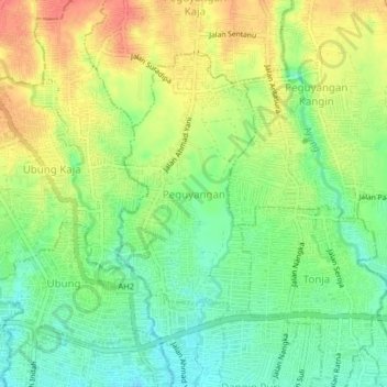
Name: Peguyangan topographic map, elevation, terrain.
Location: Peguyangan, Denpasar Utara, Denpasar, Bali, 80115, Indonesia (-8.64299 115.19322 -8.60299 115.23322)
Average elevation: 56 m
Minimum elevation: 29 m
Maximum elevation: 88 m