
South Cambridgeshire topographic map
Interactive map
Click on the map to display elevation.
About this map
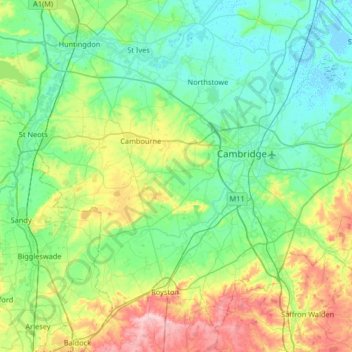
Name: South Cambridgeshire topographic map, elevation, terrain.
Average elevation: 42 m
Minimum elevation: -4 m
Maximum elevation: 171 m
Other topographic maps
Click on a map to view its topography, its elevation and its terrain.
Harston
United Kingdom > England > South Cambridgeshire > Harston
Harston, South Cambridgeshire, Cambridgeshire, East of England, England, United Kingdom
Average elevation: 20 m