
Shetland topographic map
Interactive map
Click on the map to display elevation.
About this map
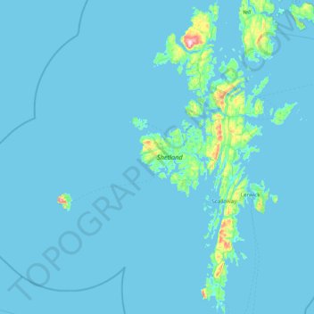
Name: Shetland topographic map, elevation, terrain.
Location: Shetland, Scotland, United Kingdom (59.85227 -1.70414 60.63770 -1.04900)
Average elevation: 11 m
Minimum elevation: -2 m
Maximum elevation: 440 m
Other topographic maps
Click on a map to view its topography, its elevation and its terrain.