
Vratsa topographic map
Interactive map
Click on the map to display elevation.
About this map
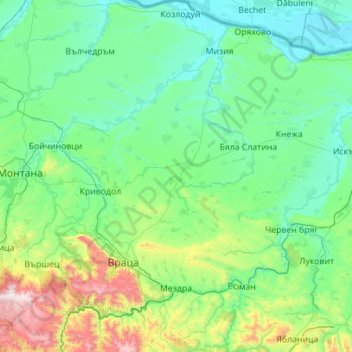
Name: Vratsa topographic map, elevation, terrain.
Location: Vratsa, Bulgaria (42.99535 23.31525 43.80580 24.32427)
Average elevation: 281 m
Minimum elevation: 22 m
Maximum elevation: 1,778 m
Other topographic maps
Click on a map to view its topography, its elevation and its terrain.