
Maastricht topographic map
Interactive map
Click on the map to display elevation.
About this map
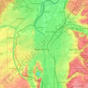
Name: Maastricht topographic map, elevation, terrain.
Location: Maastricht, Limburg, Netherlands (50.80381 5.63887 50.91200 5.76292)
Average elevation: 73 m
Minimum elevation: 12 m
Maximum elevation: 153 m
Other topographic maps
Click on a map to view its topography, its elevation and its terrain.
Eiland van Bèr
Netherlands > Limburg > Maastricht
Eiland van Bèr, Maastricht, Limburg, Netherlands, 6212 NE, Netherlands
Average elevation: 137 m