
Bull Creek topographic map
Interactive map
Click on the map to display elevation.
About this map
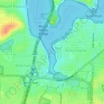
Name: Bull Creek topographic map, elevation, terrain.
Location: Bull Creek, Perth, Western Australia, 6149, Australia (-32.04557 115.85902 -32.03456 115.86244)
Average elevation: 12 m
Minimum elevation: -2 m
Maximum elevation: 40 m
Western Australia trails, hiking, mountain biking, running and outdoor activities
Other topographic maps
Click on a map to view its topography, its elevation and its terrain.