
Make a donation
Round Mountain topographic map
Click on the map to display elevation.
Make a donation
Round Mountain
With an elevation of 1,586 metres (5,203 ft) above sea level, Round Mountain is the highest peak of the Snowy Range which forms part of the eastern escarpment of the Northern Tablelands. The mountain is located in Cathedral Rock National Park, about 72 kilometres (45 mi) east of Armidale and 63 kilometres (39 mi) west of Dorrigo, and 10 kilometres (6.2 mi) northwest of the better known Point Lookout, in New England National Park. It is located a few kilometres west of the small settlement of Ebor. The nearest sealed road is the Waterfall Way, approximately 6.5 kilometres (4.0 mi) from the mountain peak.
Make a donation
About this map
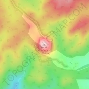
Name: Round Mountain topographic map, elevation, terrain.
Average elevation: 1,438 m
Minimum elevation: 1,287 m
Maximum elevation: 1,579 m
New South Wales trails, hiking, mountain biking, running and outdoor activities
Make a donation
Other topographic maps
Click on a map to view its topography, its elevation and its terrain.