
Northwood topographic map
Interactive map
Click on the map to display elevation.
About this map
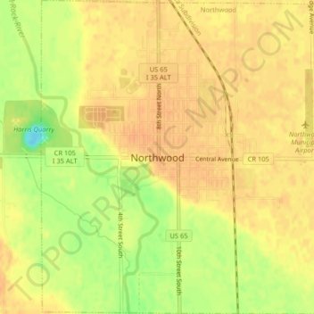
Name: Northwood topographic map, elevation, terrain.
Location: Northwood, Worth County, Iowa, United States (43.42956 -93.23598 43.45875 -93.19595)
Average elevation: 371 m
Minimum elevation: 346 m
Maximum elevation: 379 m
Other topographic maps
Click on a map to view its topography, its elevation and its terrain.
Northwood
United States > Iowa > Worth County > Northwood
Northwood, Worth County, Iowa, United States
Average elevation: 373 m