
Sandefjord topographic map
Interactive map
Click on the map to display elevation.
About this map
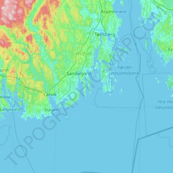
Name: Sandefjord topographic map, elevation, terrain.
Location: Sandefjord, Vestfold, Norway (58.77128 9.99256 59.38852 10.38129)
Average elevation: 45 m
Minimum elevation: -1 m
Maximum elevation: 608 m
Other topographic maps
Click on a map to view its topography, its elevation and its terrain.