
Longley topographic map
Interactive map
Click on the map to display elevation.
About this map
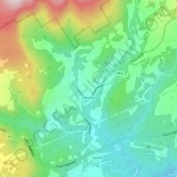
Name: Longley topographic map, elevation, terrain.
Location: Longley, Hobart, Kingborough, Tasmania, Australia (-42.98626 147.16050 -42.95606 147.20735)
Average elevation: 269 m
Minimum elevation: 108 m
Maximum elevation: 607 m
Tasmania trails, hiking, mountain biking, running and outdoor activities
Other topographic maps
Click on a map to view its topography, its elevation and its terrain.