
Saint Clair County topographic map
Interactive map
Click on the map to display elevation.
About this map
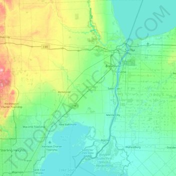
Name: Saint Clair County topographic map, elevation, terrain.
Location: Saint Clair County, Michigan, United States of America (42.47890 -82.99626 43.16895 -82.33540)
Average elevation: 201 m
Minimum elevation: 171 m
Maximum elevation: 341 m
Other topographic maps
Click on a map to view its topography, its elevation and its terrain.
Fort Holmes
United States of America > Michigan > Mackinac Island > Fort Holmes
Average elevation: 192 m