
South Banat Administrative District topographic map
Interactive map
Click on the map to display elevation.
About this map
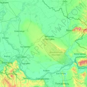
Name: South Banat Administrative District topographic map, elevation, terrain.
Location: South Banat Administrative District, Vojvodina, Serbia (44.65741 20.40891 45.33192 21.56013)
Average elevation: 107 m
Minimum elevation: 43 m
Maximum elevation: 613 m
Other topographic maps
Click on a map to view its topography, its elevation and its terrain.
Banatski Karlovac
Serbia > Vojvodina > Alibunar Municipality > Banatski Karlovac
Average elevation: 108 m