
South Banat Administrative District topographic map
Interactive map
Click on the map to display elevation.
About this map
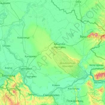
Name: South Banat Administrative District topographic map, elevation, terrain.
Location: South Banat Administrative District, Vojvodina, Serbia (44.65741 20.40891 45.33192 21.56013)
Average elevation: 107 m
Minimum elevation: 43 m
Maximum elevation: 613 m
Other topographic maps
Click on a map to view its topography, its elevation and its terrain.
Novi Sad
The city lies on the meander of the river Danube, which is only 350 meters wide beneath the marking stones of Petrovaradin. A section of the Danube-Tisza-Danube Canal marks the northern edge of the wider city centre. The main part of the city lies on the left bank of the Danube in the region of Bačka, while…
Average elevation: 135 m
Banatski Karlovac
Serbia > Vojvodina > Alibunar Municipality > Banatski Karlovac
Average elevation: 108 m