
De Pinte topographic map
Interactive map
Click on the map to display elevation.
About this map
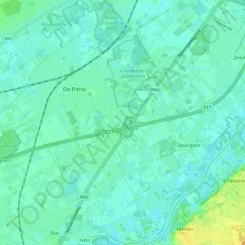
Name: De Pinte topographic map, elevation, terrain.
Location: De Pinte, East Flanders, Flanders, 9840, Belgium (50.95409 3.62363 51.01435 3.71110)
Average elevation: 8 m
Minimum elevation: 2 m
Maximum elevation: 25 m
Other topographic maps
Click on a map to view its topography, its elevation and its terrain.