
Kingfield topographic map
Interactive map
Click on the map to display elevation.
About this map
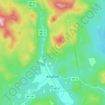
Name: Kingfield topographic map, elevation, terrain.
Location: Kingfield, Franklin County, Maine, United States of America (44.93188 -70.27200 45.03966 -70.10956)
Average elevation: 294 m
Minimum elevation: 131 m
Maximum elevation: 758 m