
Eskdalemuir topographic map
Interactive map
Click on the map to display elevation.
Eskdalemuir
In spite of it being located inland, the dull and wet nature of the climate due to the elevation leads to chilly summers that are colder than more northerly locations such as Glasgow and Edinburgh. The inland nature of the climate is more manifest during winter months with frosts being common, and the average lows between December and February are below the freezing point.
About this map
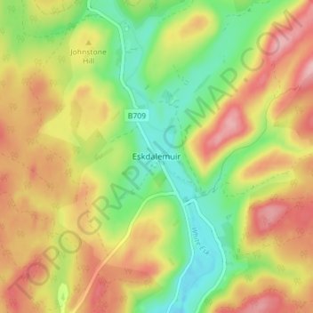
Name: Eskdalemuir topographic map, elevation, terrain.
Average elevation: 246 m
Minimum elevation: 175 m
Maximum elevation: 319 m