
Long Điền topographic map
Interactive map
Click on the map to display elevation.
About this map
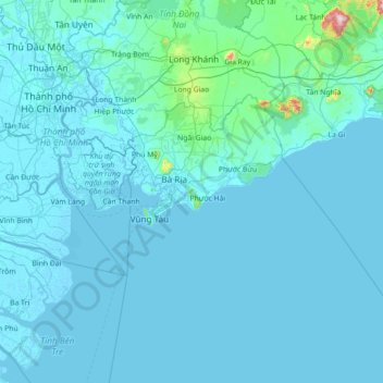
Name: Long Điền topographic map, elevation, terrain.
Location: Long Điền, Ba Ria-Vung Tau Province, Vietnam (9.74727 106.53354 11.14727 107.93354)
Average elevation: 33 m
Minimum elevation: -4 m
Maximum elevation: 1,236 m
Other topographic maps
Click on a map to view its topography, its elevation and its terrain.
Nui Dat
Vietnam > Ba Ria-Vung Tau Province > Ba Ria City
Nui Dat, Ba Ria City, Ba Ria-Vung Tau Province, 064, Vietnam
Average elevation: 45 m