
Koderma topographic map
Interactive map
Click on the map to display elevation.
About this map
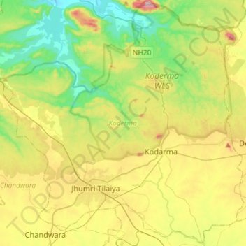
Name: Koderma topographic map, elevation, terrain.
Location: Koderma, Kodarma, Jharkhand, India (24.38582 85.43364 24.60120 85.67542)
Average elevation: 343 m
Minimum elevation: 159 m
Maximum elevation: 662 m
Other topographic maps
Click on a map to view its topography, its elevation and its terrain.
Maluti
India > Jharkhand > Shikaripara
Maluti, Shikaripara, Dumka District, Jharkhand, India
Average elevation: 56 m