
Linter topographic map
Interactive map
Click on the map to display elevation.
About this map
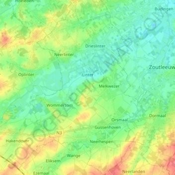
Name: Linter topographic map, elevation, terrain.
Location: Linter, Flemish Brabant, Flanders, Belgium (50.77604 4.99216 50.86842 5.09382)
Average elevation: 43 m
Minimum elevation: 23 m
Maximum elevation: 82 m