
Placid Hills topographic map
Interactive map
Click on the map to display elevation.
About this map
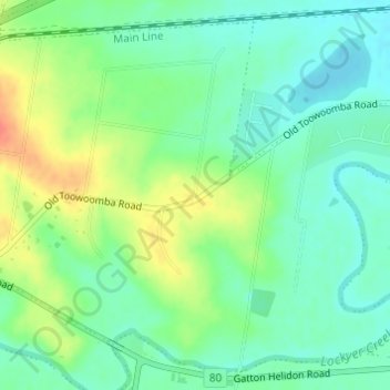
Name: Placid Hills topographic map, elevation, terrain.
Location: Placid Hills, Grantham, Queensland, Australia (-27.57139 152.22473 -27.55139 152.24473)
Average elevation: 116 m
Minimum elevation: 98 m
Maximum elevation: 147 m
Other topographic maps
Click on a map to view its topography, its elevation and its terrain.
Grantham
Australia > Queensland > Grantham
Grantham, Lockyer Valley Regional, Queensland, Australia
Average elevation: 125 m