
Mundaring Weir topographic map
Interactive map
Click on the map to display elevation.
About this map
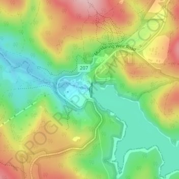
Name: Mundaring Weir topographic map, elevation, terrain.
Location: Mundaring Weir, Perth, Western Australia, 6073, Australia (-31.95675 116.16474 -31.95670 116.16518)
Average elevation: 185 m
Minimum elevation: 104 m
Maximum elevation: 285 m
Western Australia trails, hiking, mountain biking, running and outdoor activities
Other topographic maps
Click on a map to view its topography, its elevation and its terrain.