
Oise topographic map
Interactive map
Click on the map to display elevation.
About this map
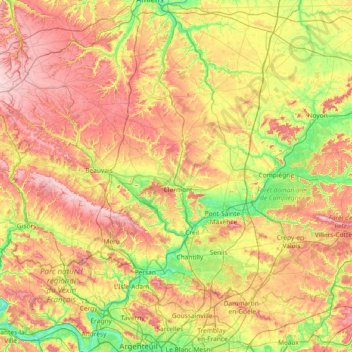
Name: Oise topographic map, elevation, terrain.
Location: Oise, Hauts-de-France, Metropolitan France, France (49.06052 1.68887 49.76374 3.16583)
Average elevation: 108 m
Minimum elevation: 13 m
Maximum elevation: 249 m
Other topographic maps
Click on a map to view its topography, its elevation and its terrain.
Prairie
France > Hauts-de-France > Cuignières
Certain extraordinary features were produced when the retreat of the ice sheet had progressed so far as to open an eastward outlet for the marginal lakes. This outlet occurred along the depression between the northward slope of the Appalachian plateau in west-central New York and the southward slope of the…
Average elevation: 136 m