
Town of Keene topographic map
Interactive map
Click on the map to display elevation.
About this map
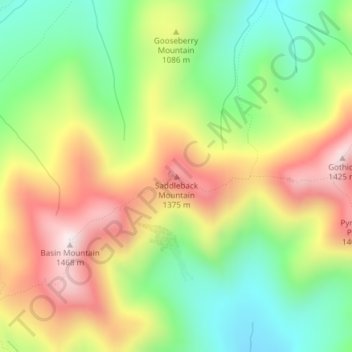
Name: Town of Keene topographic map, elevation, terrain.
Average elevation: 1,113 m
Minimum elevation: 833 m
Maximum elevation: 1,453 m
Other topographic maps
Click on a map to view its topography, its elevation and its terrain.
Village of Lake Placid
United States > New York > Essex County
Village of Lake Placid, Town of North Elba, Essex County, New York, 12946, United States
Average elevation: 558 m
Town of Newcomb
United States > New York > Essex County
Town of Newcomb, Essex County, New York, 12852, United States
Average elevation: 627 m
Brown Mountain
United States > New York > Essex County > Keene
Brown Mountain, Keene, Essex County, New York, 12942, United States
Average elevation: 488 m
Mount Lewis
United States > New York > Essex County > Crown Point
Mount Lewis, Crown Point, Essex County, New York, United States
Average elevation: 350 m