
Chatsworth topographic map
Interactive map
Click on the map to display elevation.
About this map
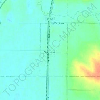
Name: Chatsworth topographic map, elevation, terrain.
Location: Chatsworth, Sioux County, Iowa, 51011, United States (42.90902 -96.51965 42.92353 -96.50947)
Average elevation: 357 m
Minimum elevation: 346 m
Maximum elevation: 389 m
Other topographic maps
Click on a map to view its topography, its elevation and its terrain.
Rock Valley
United States > Iowa > Sioux County
Rock Valley, Sioux County, Iowa, 51247, United States
Average elevation: 394 m