
Lægreid topographic map
Interactive map
Click on the map to display elevation.
About this map
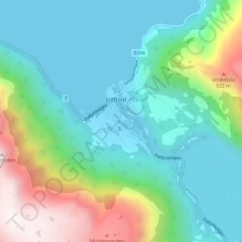
Name: Lægreid topographic map, elevation, terrain.
Location: Lægreid, Eidfjord, Vestland, 5783, Norway (60.44307 7.05190 60.48307 7.09190)
Average elevation: 325 m
Minimum elevation: 0 m
Maximum elevation: 1,280 m