
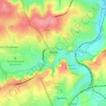
Yeovil topographic map
Interactive map
Click on the map to display elevation.
About this map
Name: Yeovil topographic map, elevation, terrain.
Average elevation: 63 m
Minimum elevation: 22 m
Maximum elevation: 113 m
Other topographic maps
Click on a map to view its topography, its elevation and its terrain.
Chard
United Kingdom > England > South Somerset > Chard
Chard, South Somerset, Somerset, South West England, England, TA20 1QE, United Kingdom
Average elevation: 135 m
Blackwater
United Kingdom > England > South Somerset > Blackwater
Blackwater, Buckland St Mary, South Somerset, Somerset, South West England, England, TA20 3LD, United Kingdom
Average elevation: 212 m