
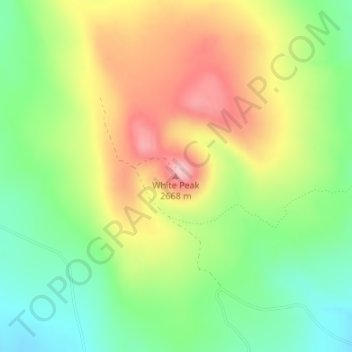
White Peak topographic map
Interactive map
Click on the map to display elevation.
About this map
Name: White Peak topographic map, elevation, terrain.
Average elevation: 2,574 m
Minimum elevation: 2,491 m
Maximum elevation: 2,676 m
Other topographic maps
Click on a map to view its topography, its elevation and its terrain.
Artesia
United States of America > New Mexico > Artesia
Artesia is located in northern Eddy County at 32°50′34″N 104°24′44″W / 32.84278°N 104.41222°W / 32.84278; -104.41222 (32.842744, -104.412315), at an elevation of 3,380 feet (1,030 m). US 82 leads east 64 miles (103 km) to Lovington and west 110 miles (180 km) to Alamogordo, while US 285…
Average elevation: 1,037 m