
Snowdon topographic map
Interactive map
Click on the map to display elevation.
About this map
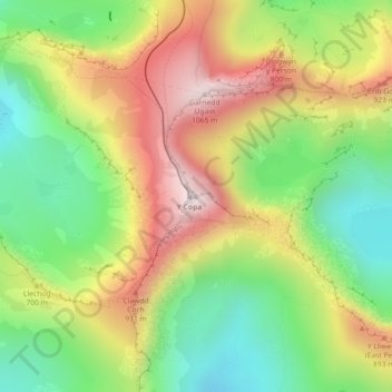
Name: Snowdon topographic map, elevation, terrain.
Location: Snowdon, Bangor, Gwynedd, Wales, LL55 4UL, United Kingdom (53.06843 -4.07623 53.06853 -4.07613)
Average elevation: 692 m
Minimum elevation: 390 m
Maximum elevation: 1,061 m
Other topographic maps
Click on a map to view its topography, its elevation and its terrain.