
Sublime Point topographic map
Interactive map
Click on the map to display elevation.
About this map
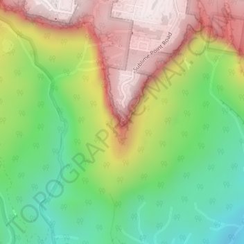
Name: Sublime Point topographic map, elevation, terrain.
Average elevation: 557 m
Minimum elevation: 220 m
Maximum elevation: 954 m
New South Wales trails, hiking, mountain biking, running and outdoor activities
Other topographic maps
Click on a map to view its topography, its elevation and its terrain.
Jamison Valley
Australia > New South Wales > Sydney > Leura
South of Mount Solitary, the valley sprawls through Cedar and Kedumba Valley down to Coxs River and Lake Burragorang, the lake that was created when Warragamba Dam was built. There is a 3 kilometres (1.9 mi) prohibited area around the river and lake to protect Sydney's water supply. Around this area there is a…
Average elevation: 578 m