
Oberkochen topographic map
Interactive map
Click on the map to display elevation.
About this map
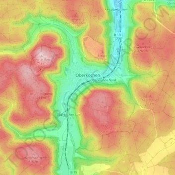
Name: Oberkochen topographic map, elevation, terrain.
Location: Oberkochen, Ostalbkreis, Baden-Württemberg, 73447, Germany (48.75329 10.05645 48.80899 10.14846)
Average elevation: 612 m
Minimum elevation: 459 m
Maximum elevation: 744 m