
Telfs topographic map
Interactive map
Click on the map to display elevation.
About this map
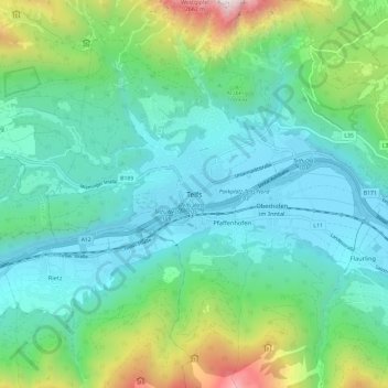
Name: Telfs topographic map, elevation, terrain.
Location: Telfs, Bezirk Innsbruck-Land, Tyrol, 6410, Austria (47.26465 11.03152 47.34465 11.11152)
Average elevation: 1,023 m
Minimum elevation: 608 m
Maximum elevation: 2,431 m