
Mount Seaview topographic map
Interactive map
Click on the map to display elevation.
About this map
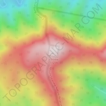
Name: Mount Seaview topographic map, elevation, terrain.
Average elevation: 725 m
Minimum elevation: 306 m
Maximum elevation: 1,094 m
Other topographic maps
Click on a map to view its topography, its elevation and its terrain.
The Cells State Conservation Area
Australia > New South Wales > Mount Seaview
The Cells State Conservation Area, Mount Seaview, Port Macquarie-Hastings Council, New South Wales, 2446, Australia
Average elevation: 724 m
Gingers Creek
Australia > New South Wales > Mount Seaview
Gingers Creek, Mount Seaview, Port Macquarie-Hastings Council, New South Wales, Australia
Average elevation: 719 m