Geolocate

Gunung Geulis topographic map

Interactive map

Click on the map to display elevation.

About this map

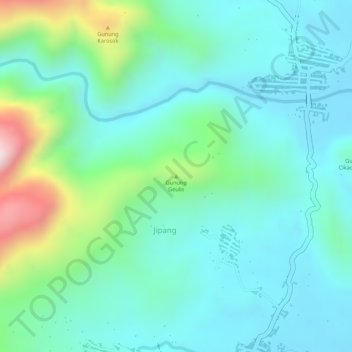
Name: Gunung Geulis topographic map, elevation, terrain.

Location: Gunung Geulis, Brebes, Central Java, Indonesia (-7.19422 108.90356 -7.19412 108.90366)

Average elevation: 166 m

Minimum elevation: 60 m

Maximum elevation: 488 m

Other topographic maps

Click on a map to view its topography, its elevation and its terrain.

Semarang

Indonesia > Central Java

Semarang is located on the northern coast of Java. The city of Semarang is one of the most important cities located on the north coast of Java and is the main hub connecting Jakarta and Surabaya, and cities in the southern interior of Java Surakarta and Yogyakarta. Semarang City has a height ranging from 2 m…

Average elevation: 110 m

Sragen

Indonesia > Central Java

Average elevation: 134 m

Wonosobo

Indonesia > Central Java

Wonosobo has an elevation moderated tropical rainforest climate (Af) with moderate rainfall from July to September and heavy to very heavy rainfall in the remaining months. The following climate data is for the town of Wonosobo.

Average elevation: 876 m

Boyolali

Indonesia > Central Java

Average elevation: 277 m

Karanganyar

Indonesia > Central Java

Average elevation: 408 m